Wednesday, March 31, 2010

March 31 - Towpath Avenue


Today is the last day of March - a month that has been full of change and wonder, and has seen us out on the trail more than ever! Today also marks one quarter of the year under our belts! So far we have enjoyed every moment of our time on the trail, looking at our photos afterward, journaling about our day, and planning our next outing.
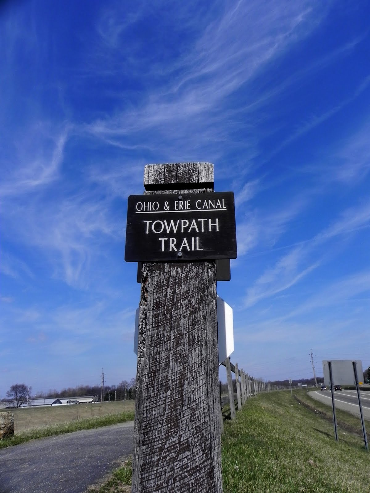
Today I went to the trailhead on Towpath Trail in Massillon. I walked north for awhile, then turned back since I had to go back to work. It was so nice out today. I remember not that long ago not being able to get more than a few feet on this part of the trail without being totally snow-covered. Today spring was very evident - blossoms everywhere! Let's see what April brings - besides showers!!

Goodbye fickle March
With varied and sundry ways
Transition, that's you!

Tuesday, March 30, 2010

March 30 - Lock 4 Park to Butterbridge


Today after work, I decided to walk along a part of the trail I had not been on before. Yes, there are a few such sections remaining! I parked at Lock 4 Park in Canal Fulton. This is a park that is actually centered around the canal and its history. The sun was shining and it was in the high 50's. The park area was beautiful. I walked towards Butterbridge Road, and it was a very scenic walk. Some of the trees along the canal here are gnarled looking and very interesting. I saw a few woodpeckers, and heard a loud chorus of frogs off towards the trees near the river, to the west. When I got to Butterbridge Road, I crossed the street and saw signs stating that the trail was closed here. I can only deduct that it is closed because the trail is flooded in parts, although it was fine as far as I could see. I turned around and went back to the park. A pleasant walk overall!

The awe continues
Trees gnarled like in fairy tales
Sights and sounds, sunshine

March 30 - Reminiscing

It's 6:30 a.m. I haven't been out on the trail yet today, but i was thinking about our Boy Scout hike in 1999, which covered 20 miles of the trail. I don't remember too much detail about the trail back then, but I got out my hiking binder to see what has changed since then. I know that a significant amount of construction has been done in recent years, especially south of where we hiked in '99. I'll investigate more after work today, when I have time to go through my binder. I will also have to dig around and see if I can find any photos of our hikes back then. Here's hoping.

Striving to recall
Wanting to remember all
Bits, pieces break through

Sunday, March 28, 2010

March 28 - Vanderhoof and Van Buren


I have often regretted where we built our house, because it is kind of out in the "boonies." A half hour to work, a half hour to Copley, 15 minutes to shopping. But when I sat down and "did the math," I realized that nine of the Towpath trailheads are within 15 minutes of our house, eight more are within twenty minutes, and all are within an hour.
This is important because when the weather changes or for some reason we have some extra time, there are multiple sites on the trail that we can get to within a few minutes.
This is what happened today. The forecast had been for rain all day, but when we saw a break in the rain, we decided to take off and go to Vanderhoof Rd., where we have had good luck with bird photos. The after effects of the rain, with all the trees and wooden structures darkened, and the dramatic skies all made for wonderful photos. We also saw some large flocks of red-winged blackbirds landing in trees that were visible from the trail. We went north of Vanderhoof where the trail runs close to Van Buren Rd. and we could actually hop out of the car and onto the trail. (This is unusual for the Towpath Trail, as it runs for miles in some sections with no access from the road.) All in all, a great day, considering we hadn't plan to go out at all!

Unplanned excursion
Red-winged blackbirds still coming
Fill the trees with song

Saturday, March 27, 2010

March 27 - Back to Tusc County

Kay, the tree hugger
Today we drove south into Tusc County again to Bolivar to the Fort Laurens Memorial, where there is a towpath trailhead. This is a very pretty area, with a tomb of an unknown soldier form the Revolutionary War. Once on the trail, we quickly came to a bridge that carries the trail right over I-77. This is very cool, to be able to walk above this major highway and still be on the towpath trail. Not too far in, there are three locks in close proximity to one another. We heard several pileated woodpeckers today, but neither of us was able to get a photo of any of them! We walked to the 82 mile marker, which is where I had left off last time we went to Zoar. It was chilly today, but partly sunny, which made for great hiking weather. A very pleasant outing indeed!

Man-made construction
History and nature blend
Is that you, Woody?

Friday, March 26, 2010

March 26 - Butterbridge


Today was one of those unplanned treks that just wouldn't end! We started at Butterbridge Road and walked south. We had walked part of this trail before but the weather wasn't as nice and we hadn't gotten very far. An almost-full moon was shining above and although it wasn't chillier than it had been,, it was sunny and pleasant. We had planned to walk as far as Crystal Springs, but we didn't get started until around 5:00 and it was a 5.8 mile round trip. We walked and walked and walked. The trail passes by the backs of some beautiful houses along this stretch. We saw sosme deer but they ran away too fast for us to take their portraits. We did take photos of some muskrats and various birds along the way. We decided to turn around at about 6:20, so we wouldn't run into darkness. We hadn't come prepared for that, even though Kay has been anxious to start tracking some nocturnal critters. Speaking of nocturnal, we did hear a Great Horned Owl in the trees, but did not catch a glimpse!

Chilly, getting dark
An owl stirring in the trees
Why can't we see you?

Wednesday, March 24, 2010

March 24 - Lake St. Flood!!


I had some time between being at the Canton office and needing to arrive at the Massillon office, so i stopped at one of our favorite standby trailheads, Lake St.
It was pleasant out, but I didn't have much time, so I decided to mill around the Lake St. parking lot adjacent to the trail. There were some robins hunting for worms, and I even spotted some blossoms on the of the trees along the river. What a surprise when I looked to my left and saw that the trail under the Lake St. bridge was completed flooded and impassable. A woman on a bike soared up to where I was standing and we both gasped at the same time as she slammed on her brakes. The river is really high here. Hope it goes down soon and that the trail is passable again.

With spring comes the rain
Adding to the melting snow
Water everywhere

Sunday, March 21, 2010

March 21- Forty Corners


Today was a nice, seasonal first day of Spring. I drove to the Forty Corners trailhead in Jackson Twp. and walked south to Bridgeport Quarry. It was 56 degrees and partly sunny when I started. I could hear lots of birds singing, and the tops of the trees were filled with spring buds. Turtles were gracing just about every log in the canal. It felt so good to be walking along the trail with the sun shining down and signs of spring everywhere. I turned around at Bridgeport Quarry and walked back to Forty Corners. I then walked in the other direction, towards Crystal Springs. Although I thought I was walking due north, when I looked at the map tracking my steps, I was surprised to find that the second leg of my journey had been on a curve that headed mostly west. Lots of walkers, joggers and bicyclists out today. I walked back to Forty Corners and drove home, happy to have started a new season on the trail!

Spring is finally here
Wildflowers, turtles, so much green
Starting all over

Saturday, March 20, 2010

March 20 - Merriman Rd. to Summit Lake


If that's the Good- year Blimp, this must be Akron! Today I rode my bike along the trail. Kay and I drove to the Big bend area on Merriman Road. She set up on the trail to look for birds. It was chilly when I started riding, about 50 degrees. I rode south with no particular destination, since this was my first ride this year. It was very pretty near the Merriman Road area, with a beautiful boardwalk bordering Valley View Golf Club. I rode down to the Mustill Store and continued to the cascade Locks area. This is a part of the trail with several locks in a row. Unfortunately, some of the locks were destroyed when Route 59 was built in Akron. As I rode south, I encountered the only significant grade in the trail I have seen so far. Two different areas had signs indicating a 5% grade. I was getting so hot at this point that I walked my bike up the grades to save energy. (By this time it was 66 degrees.)I rode over Route 59 on the awesome towpath bridge, and continued on through downtown Akron. I passed the Canal Square YMCA and Canal Park, home of the Aeros. I decided to keep going because I knew there was a break in the trail here, and I wanted to investigate. When I got to the parking lot behind Spaghetti Warehouse, the trail ended. There were signs, however, directing me to continue on in order to get to where the trail resumed. I passed some industrial and seemingly deserted areas, following the signs. I came upon an area of condos that backed up to the trail and the canal, and where a beautiful park-like area had been created. I had just passed some smokestacks labeled "Goodrich," when I looked up and saw the Goodyear Blimp! Aw, Akron!
I kept riding and found the trail again just north of Summit Lake. I called Kay and had her pick me up here. I rode about 6 and a half miles today. It was enjoyable, but it was also more difficult to take photos. As far as needing to explore areas of the trail, to search for gaps, etc., a bike is the way to go!


Alone exploring
What would John R. Naples say
If he saw me there?

Friday, March 19, 2010

March 19 - Lake St., Bridgeport Quarry, Canal Fulton, Clinton


Today was a big day! We started off at lake St. at Ernie's Bike Shop. We decided to purchase a bike rack for Kay's car, so we could ride our bikes on the trail sometimes. Ernie was very helpful, and actually installed the rack on Kay's trunk. Afterward, we decided to walk south, to see how far we could get. (We knew the trail was interrupted for awhile near Lincoln Way.) We got to Lincoln Way and saw signs for a Towpath detour. We followed the signs, which sent us under bridges, along railroad tracks, through city streets, but we never did find where the trail resumed to the south. WE got as far as Tremont Street and turned around. When we got back to Lake St., we stopped and had lunch at the Blue Heron Deli. Since it was in the 60's and sunny, we ate outside. What a wonderful feeling!
Kay wanted to drive north and look for birds. I told her to meet me around the Bridgeport Quarry trailhead, about one and three fourths miles to the north. I set out on foot and Kay drove her car. It was so beautiful out. Along the way, I spotted some small white flowers, the first blooms I'd seen yet this year! How exciting! We met up at Bridgeport Quarry and took some photos. Our plan then was to drive home and get my bike. We would then drive to Canal Fulton and I would ride north. We loaded up my bike onto the new bike rack, but as soon as we got to Canal Fulton and I hopped onto it, it became obvious that I had a flat tire. Bummer! I decided to go ahead and walk to Clinton, where Kay would meet me. It was a long walk, about four miles. The area just south of Clinton was very pretty, and the trail was paved here for awhile. I had remembered walking here before with my friend Amanda and seeing the signs for Stark and Summit Counties. By the time i got to Clinton, I was getting tired. I had walked about nine and a half miles today. Whew!!

At last the snow thaws
We go where we've yearned to go
A long, lovely day

Thursday, March 18, 2010

March 18 - Boston Mills, Valley View, Brecksville


Since Kay wanted to go back to the site of the eagles' nest in Brecksville, I decided to drop her off and head out to some other areas on my own. My first stop was to the Red Lock trailhead which is on Vaughn Road, near Brandywine. I walked south with the goal of reaching Boston Mills Rd. It was another beautiful day, 61 degrees and partly sunny. My walk was thoroughly enjoyable. I could hear all sorts of birds, including several pileated woodpeckers, but none of the little rascals were interested in posing for me. I also heard the loud ruckus made by "peepers," a type of frog. I stopped to take lots of photos when I got to the trailhead on Boston Mills, including photos of the Boston Store and the Pure gas station. Since I was so close, I kept walking south to one of my favorite areas to view the I-271 and I-80 bridges. I stopped under the first bridge, I-271, and took a few photos, then turned around and headed back to Vaughn Rd. I called Kay from the car, and she was still going strong in Brecksville.
I drove up to Valley View to the Canal Visitor Center/Lock 38. From there I walked south. Kind of boring as the trail runs along the road here. I did stop at Tinker's Creek Aqueduct and took some photos of a Belted Kingfisher. There was one here last time I stopped back in January. I was disappointed to see that the trail was blocked for construction on the Fitzwater St. bridge. I had seen signs posted in other areas of the trail, warning of this closing, but I guess I hadn't known exactly where this was until now! I had no choice but to turn around.
I went to Brecksville and walked to where Kay was on the trail, just north of the eagles' nest. We stayed there awhile, and then I helped her carry her gear back to the car. It was still warm and sunny out, 64 degrees.

Majestic eagles
She watches with great patience
While she waits, I trek

Wednesday, March 17, 2010

March 17 - Lake Nesmith to Summit Lake


Mute Swan

Today we started at the Manchester Road trailhead, just south of Lake Nesmith. We had stopped here before, but had not ventured very far in either direction. Today was sort of a cool day - 40 degrees - but it was mostly sunny. We walked northeast, which is how the trail runs here. We were walking along the canal and there were houses whose back yards were right on the canal. It was sort of junky in this area, but we did encounter a surprise. Off to the east, in the distance, we saw a heron rookery that we didn't even know existed. At first we thought it might be abandoned, but then we say some herons in the nests off in the distance. We also saw a white swan in the canal, which was very pleasant. One of the things we passed was a sign noting that we were at the highest elevation of the entire canalway. That was pretty exciting. At one point, Kay decided she wanted to stop and watch for birds. I kept walking and made it all the way to Summit Lake in Akron. Kay headed back to the car when she was done bird watching and picked me up at the Summit Lake trailhead.

Surprise heron's nests
A swan swims in the canal
High elevation

Tuesday, March 16, 2010

March 16 - John Glenn Grove


This afternoon, after work, Kay and I decided to meet at the Warmington St. trailhead, south of Massillon. The area is called John Glenn Grove. There is a bronze statue of the top half of John Glenn gracing the spot. Although it's called a grove, I didn't notice any obvious clusters of trees. It was a very pretty, unseasonably warm late winter day - 60 degrees and sunny. It felt so exhilarating to be out on the trail and to be able to walk as far as we wanted with ease. The sun shining onto the river and illuminating the trail felt so good.
We walked and walked and before you knew it, we were very close to the next trailhead, on Wooster St. in Navarre. I was able to convince Kay to keep going to the next trailhead. There wasn't necessarily anything amazingly picturesque, but it was just so warm and sunny and pleasant out, we took pictures of the warm glow of the sun as we basked in the warmth.

Still winter yet warm
Walking longer than we planned
Sun chasing doldrums

Monday, March 15, 2010

March 15 - Brecksville, Peninsula


We decided to go back to Brecksville Reservation today to check out the eagles' nest. First we stopped up top on Route 82, on the bridge and took some photos of the towpath area from the bridge. I got some shots looking down the side of the bridge, looking at the river, the railroad tracks and the towpath trail below. We then found a path that led down beside the bridge. After going down the path and taking some photos, we got back into the car and drove down to the Station Road trailhead parking lot. It was 42 degrees and cloudy - even a few sprinkles now and then.
Kay decided to plant herself and her equipment on the trail just north of the eagles' nest. I walked north to Frazee House. It was a nice walk, but I kept seeing hawks circling above, and it made me kind of skittish. I turned around at Frazee House and walked back to where Kay was stationed. She agreed that we could call it a day at this location. We drove south to Boston Mills Road and hiked south for awhile. We walked under the I271 and I-80 bridges. Kay hadn't been on this part of the trail yet. We walked south for awhile, beyond the bridges. It was so beautiful. Although the sky was still cloudy, it had taken on a little bit of a dramatic look now. There was a marshy area just beyond the bridges that was very pretty. Kay decided to go back to the car and drive to Peninsula. I agreed to walk to Peninsula and meet her there.
This was a wonderful walk for me. It sort of reminded me of my childhood, exploring the wooded area around our house with my oldest brother, and sometimes even getting lost!
I walked along a beautiful boardwalk that extended about a quarter of a mile in the Stumpy Basin area. I passed a railroad bridge, and then saw a heron across the river on the bank. I love the views of the river here, and I love that the abundant wildlife signals that the river is getting very healthy again.

On the bridge we go
Looking down to where we've been
Too high - down is good!

Sunday, March 14, 2010

March 14 - Clinton Waterworld


Today I stopped at Clinton on my way to Copley to watch the Cavs game with the local family members. I didn't get far because Friedrick was with me and I realized I didn't have a leash. I didn't want to leave him in the car too long, so I didn't go very far in. I did notice that things were very watery, and that part of the trail was underwater. I guess this is a sign that spring is certainly on its way!

Just dabbled today
Family and other passions
Be back soon, towpath

Saturday, March 13, 2010

March 13 - Back to Zoar!


Zoar is one of the stops on the trail that lies most towards the south. We parked at the Canal Lands Park Trailhead lot. At first we walked south for about 3/4 of a mile, but were unable to go on, as the trail was flooded. On our way south, however, we heard the unmistakable call of the Pileated Woodpecker, one of our favorite birds. We were able to snap a few photos before he vanished.
There is a bridge here that used to carry automobiles but now only accommodates foot traffic. It is a beautiful iron bridge and is always the subject of many photos when we are in this area. There are wooden stairs that lead from the trail up to the bridge. The bridge affords a nice view of the Towpath.
There are locks to the north, including Lock 10, which we passed. If we had gone farther north, we'd have seen Locks 7, 8, and 9. These locks are south of the Ft. Laurens area and the bridge over I-77 that we visited a few weeks ago.
We saw two of the cement mile markers, 82 and 83, like the ones far to the north. These markers designate distance south from Lake Erie, but are missing in some areas, such as Stark County and parts of Summit County.

Me and my bridges
From this one, see the towpath
Such a nice mix

Friday, March 12, 2010

March 12 - Lake Street to Cherry Street -Finally!


The Lake Street Trailhead in Massillon has been one of our favorite "go-to" spots. The problem has to this point been deep, deep snow. In fact, when the parking lot here has been plowed, the snow near the southern entrance to the trail has been impossible to traverse.
Today was a different story. The snow was all melted. We walked south from about 5:40 for about 40 minutes. We got all the way to Cherry Street, a long-held goal that we could finally achieve. The trail runs along Route 21 here. Tonight the clouds were very pretty and dramatic, and the sunset was golden orange. We even stopped at the Blue Heron Deli for a sandwich afterward!

The latest snow melts
Drama in the sky, sunset
Nice to see the ground!

Thursday, March 11, 2010

March 11 - More Beaver and the "Massillon Bayou"


This after noon we traveled to the Butter bridge area in Massillon and walked south. Almost immediately we saw a beaver splashing around in the canal. What a surprise! For years we have struggled to spot a beaver in the Beaver Marsh area, and now we are seeing one in Massillon just 2 days after our sightings at the marsh!
What was very evident today was that all the melting snow has caused flooding, making this area look like a marsh. We walked for about a mile, but it started getting dusky, so we headed back to the parking lot and lingered along the river just north until sunset. A very enjoyable walk in uncharted territory!

Covering new ground
Melting snow, changing landscape
A beaver surprise

Tuesday, March 9, 2010

March 9 - Botzum to Beaver Marsh


We met at the Botzum trail- head. This is one of the trails I had wanted to hike for awhile, but that had been too snowy. We decided ahead of time that Kay would mill around the trailhead and look for birds and other critters, and I would walk towards the Ira trailhead. Kay would then drive to Ira, and we would meet at the beaver marsh.
I enjoyed my walk along the trail, and even spotted my first official Blue heron from the trail. I passed 2 locks on the way and a third between Ira and the marsh. It was a very scenic walk, and the trail runs along the train tracks for awhile. It also runs along the Cuyahoga River, which was lit up in gold as the sun descended.
When I arrived at the Beaver marsh, a man pointed out a beaver to us. We then saw and photographed several more traveling between the boardwalk area and a structure that they had built. Some of the beaver were adults and some were juveniles. They weren't shy about coming around us humans, but they swim very quickly, making them sometimes hard to photograph!
Lots of geese, and even some red-winged blackbirds, which contrary to the popular robin belief, are said to be the true harbingers of spring!

First heron, beaver
Locks and railroad tracks beheld
Euphoric spirits!  

Sunday, March 7, 2010

March 7

White-breasted Nuthatch
With apologies to the Canadian side of the family...O, Peninsula!
From tall trees, to bridges, to birds of many species, to quaint local scenery, to wetlands, to fabulous views of our beloved "crooked river," Peninsula has it all!
I parked at the Peninsula Depot Visitor Center, which was fairly filled with cars, and just took in the beauty that was within a few yards. Lock 29 is right there, along with a wonderful panoramic view of the Cuyahoga River. The trees are so tall here and are filled with birds. I walked north for about a mile, then doubled back. When I got to my starting point, I headed south towards Deep Lock. I was actually hot today, as the temperature was in the mid 60's. I turned around shortly before I got to Deep Lock Quarry, and enjoyed the scenery around the parking lot once more. Lots of hikers and bikers on the warm, sunny day!

To Peninsula
Has it changed since '99?
Oh, crooked river!

Saturday, March 6, 2010

March 6 -Center Road south to Lock 3


We rushed out this morning because it was one of those foggy/frosty days. The trail was pretty, but it wasn't an area that had been hit by much fog, unfortunately. We walked south from the Center Rd. trailhead until we got to Lock 3, which is a little north of the Clinton trailhead. The trails was a lot more navigable, and we were actually able to stand on areas of several inches of snow which were very strong. On our way back to the car, two women were walking with a very large black lab. The dog was not on a leash and jumped up on Kay. If there is one trend I am seeing, it's that there are a lot of very inconsiderate dog owners using these trails, including dogs not on a leash, and dogs not being cleaned up after. Huge, huge problem on the towpath. Come on people!

Chasing fogginess
Dogs I can see anywhere
Standing on deep snow

Friday, March 5, 2010

March 5 - Canal Fulton to Lock 4 Park


Today I left work early because I was at a 2-day work outing at a location with blaring fluorescent lights and my eye was killing me. I rested for awhile and then Kay and I decided to head to Canal Fulton Community Park and walk south. The sun was shining and it was in the mid-thirties - a beautiful late winter afternoon. We walked along the canal, under wonderful blues skies. Lots of ducks and geese along the water. The canal was on our left as we traveled south, and over a bit to our right was the Tuscarawas River. We walked to Lock 4 Park, about a mile south of where we started. It is a very quaint little area with a lock and some bridges and a little "replica lock tender's house." There are also picnic tables here that offer views of the canal, the trail and the river.

Nature as refuge
Winter not an enemy
Blues skies and sunshine 

Monday, March 1, 2010

Hope Marches In! March 1


Northern Cardinal

Today was the first day of March and it was in the mid- thirties with actual blue sky visible. We went to one of our favorite birding spots on Vanderhoof, right before Kay's evening class. We had just been here 2 days ago and it was cold, gray, and sleeting. I know we have a few weeks before spring is officially here, but this was a nice preview!

Sunshine brings reprieve
In marches the month of spring
A fine sneak preview!